Virginia's Many Counties
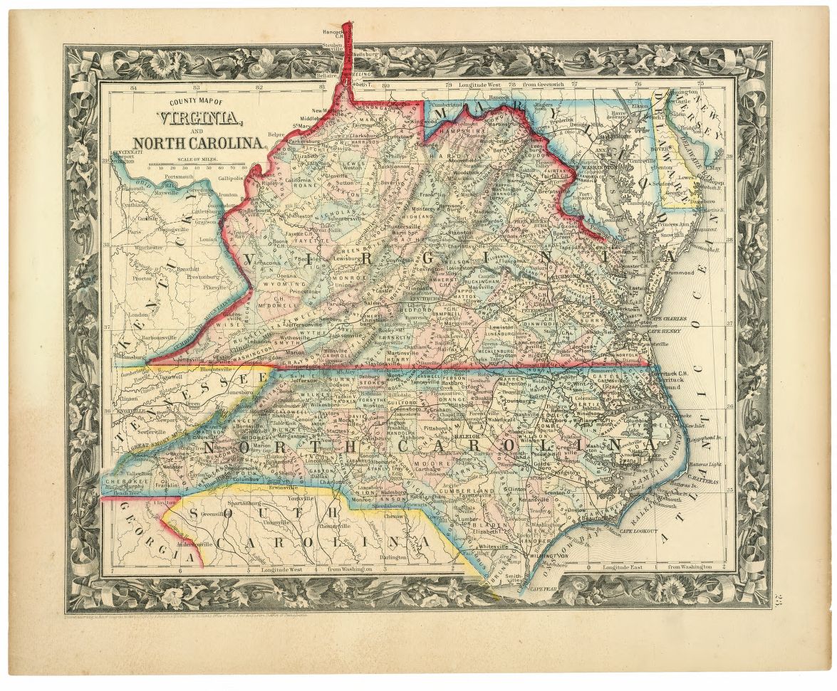
While following the election coverage the other night on the interwebs, I was zooming in and out on the state-by-state and county-by-county voting results. As the precincts reported, I was struck by the incredibly high number of counties in Virginia. The map of the Commonwealth is packed with small jurisdictions, including our very own Arlington County, which is among the smallest counties in the nation. Most of the other state maps didn’t seem nearly as busy.
So, I did a little research… Turns out my eyes weren’t playing tricks on me (always a concern when staring at a computer screen at 1am, but I digress…). If you count the 39 cities that are administered independently but operate similarly to county governments, Virginia – the 35th largest state – has the third most counties in the nation – 134! (Of personal interest to me, my home state of Georgia was second with 159. Texas was #1 with 254 because, you know, everything is bigger in Texas.)
So why are there so many counties in Virginia? Well, at least part of the answer is lies in the Commonwealth’s colonial origins.
When English settlers came to America, they brought their English traditions of governance with them. The system of locally administered counties under a plural executive structure had been in use in England for hundreds of years. When the colonists started arriving en masse in America, how they spread out and lived was very much dictated by these traditions, but also by the geography and the climate of the particular place they settled.
In the northern colonies, cold weather and less space for farming drove people into closer proximity with one another. In some places, there were even laws that banned people from living too far from the village or city center.[1] County governments proved to be superfluous. Eventually, Connecticut, Rhode Island and Massachusetts even did away with parts of their county governmental system completely, leaving most administration duties up to city governments and the state.
In the south, good farmland and fair weather allowed people to spread out and adopt a social and political landscape that looked much like the manorial system of the English countryside. Because people were more spread out, the vesting of authority in town or village councils was not as effective as it was in the north, and so the county system flourished in the rural south. As people moved into different places, they demanded localized services (courts, magistrates, etc.) from their governments, so new municipalities in the English manorial style sprung up just about everywhere people settled down and planted.
The accessibility of justice and services for all was a prime consideration in the creation of more counties, and as more people moved, more localized courts and governments were needed. In her book How Justice Grew Virginia Counties, Martha W. Hiden also points to social reasons for the creation of more courts, noting that for the rural plantation owner, “while on business at court, he had opportunity to see his friends, play cards, gamble, race horses, fight, drink, ‘swap’ horses and other livestock, attend the muster of county militia to which he belonged, and see the newest articles imported from England. The county court and his parish church services were his chief contacts with the world that lay beyond his plantation.”[2]
The population spread happened relatively early in Virginia as compared to other places. It was, of course, the first colony to be settled (at Jamestown in 1607). It was also the most populated colony during the colonial period[3] and the headright system, which granted 50 acres of land to immigrants who paid their own way to the colony and lived there for three years, encouraged expansion. Waves of farmers sought to establish themselves and lay claim to new lands. In doing so, they pushed the European population further and further from the original settlement at Jamestown.[4]
It soon proved ineffective and inefficient to govern such a large geographic area from a central location. So, in 1634, the General Assembly established eight counties (originally called “shires”) for the purpose of local administration. As settlers’ expansion continued, more counties were added and existing ones were subdivided repeatedly so that the government would be always be close to the people.
This desire is probably the root of the popular legend that county lines were drawn so that every citizen should be within a one-day round trip by buggy or wagon from the seat of the county government. (I’ve actually heard the same thing said about Georgia, which followed a somewhat similar pattern of farming expansion.)[5] That particular requirement may be more of an old wives' tale than an actual law, but the sentiment holds true, and remains reflected on our map today.
In the end, Virginia’s glut of counties can be traced to the particular geographical, economic and social situations that emerged during colonial times. Other areas of the country, which were settled later or have different population density, did not necessarily follow the same pattern. And, as transportation and communication methods improved over time, it makes sense that the counties would be larger in those newer areas. To that point, have you seen the size of some of the counties in the states out west? They’re huge!
If you are interested in this kind of thing, check out the Newberry Research Library’s Historical County viewer. It’s a great tool that tracks county boundaries over time.
Footnotes
- ^ “History of County Government, Part I” National Association of Counties,http://www.naco.org/Counties/Pages/HistoryofCountyGovernmentPartI.aspx (Accessed 11/7/2012)
- ^ Hiden, Martha W. How Justice Grew Virginia Counties. University of Virginia Press, (June, 1957) p. 10
- ^ Estimated Population of American Colonies, 1630-1780 from 1998 World Almanac and Book of Facts, pg. 378 (Source: Bureau of the Census, U.S. Dept. of Commerce) http://merrill.olm.net/mdocs/pop/colonies/colonies.htm (Accessed 11/8/2012)
- ^ “Expansion of Settlement in Early Virginia,” Jamestown and Yorktown Settlement Victory Center http://www.historyisfun.org/pdf/Curriculum-Materials/Expansions_of_Settlements.pdf (Accessed 11/8/2012)
- ^ “A Brief History of Georgia Counties” Digital Library of Georgia, http://georgiainfo.galileo.usg.edu/countyhistory.htm (Accessed 11/7/2012)



![Sketch of the mythical fuan by Pearson Scott Foresman. [Source: Wikipedia]](/sites/default/files/styles/crop_320x320/public/2023-10/Goatman_Wikipedia_Faun_2_%28PSF%29.png?h=64a074ff&itok=C9Qh-PE1)


